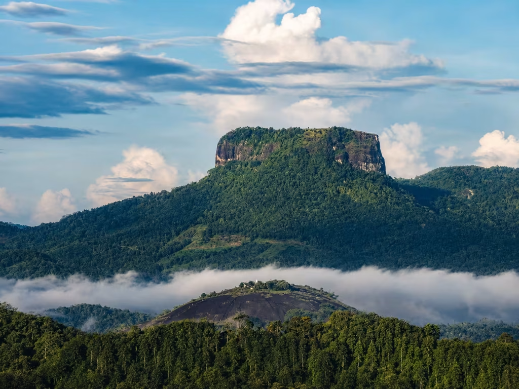
Bathalegala is one of the most recognizable mountains in Sri Lanka’s central-western highlands. Known in English as Bible Rock, it rises with a broad, flat-looking summit that can be seen from major routes approaching the central mountains. From a distance, the mountain’s profile resembles a large book or table standing above the surrounding ridges, which explains the popular nickname.
For travelers who enjoy walking, Bathalegala offers a very different experience from Sri Lanka’s famous coastal attractions and ancient cities. The hike is not a polished resort activity. It passes through a lived-in rural landscape and climbs toward an exposed summit area where weather, trail conditions and personal fitness matter.
Where is Bathalegala?
Bathalegala is in Kegalle District, in the broader Mawanella and Aranayake region. It is visible from parts of the road and railway corridor that climbs toward Kandy, especially around Kadugannawa and Balana. Central Province tourism material also identifies Bathalegala as a major mountain visible from the Balana area.
Because the mountain is not directly beside a major tourist town, reaching the normal trailhead usually involves local road travel. A tuk-tuk or vehicle with a driver familiar with the area can make the approach easier.
Why is it called Bible Rock?
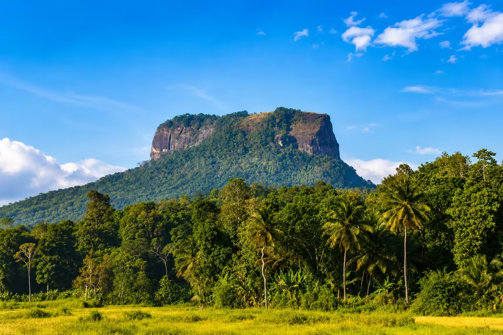
The English nickname comes from the mountain’s distinctive outline. From some viewpoints, the long flat top and steep sides resemble an open book or a large Bible. Local names and interpretations are more important than the English tourist nickname, but the comparison has become widely used in travel writing.
The shape is particularly striking when viewed from a distance because the summit appears almost level while the sides rise steeply from lower terrain.
What is the hike like?
The experience changes as you climb. Lower sections pass through village and cultivated areas, while upper portions become steeper and more exposed. Depending on the chosen route, you may encounter rock, earth, grass and sections where the path is less obvious than on a heavily developed hiking trail.
Do not judge difficulty only from distance. Heat, humidity, rain and steep ground can make a relatively short mountain feel demanding. Start with enough daylight and turn around if weather becomes unsafe.
Who should hike Bathalegala?
The mountain suits travelers with moderate fitness who are comfortable walking uphill on uneven terrain. It is not a good place to test completely new footwear or attempt a difficult climb after several exhausting travel days.
Families with children should assess the conditions carefully because exposed areas and steep edges require close supervision. Travelers with vertigo may find some summit areas uncomfortable even if the climb itself is manageable.
Why a local guide can be worthwhile
A local guide is useful when trail markings are unclear, weather has changed the route or you want to understand the surrounding villages and landscape. Guides can also help avoid accidental entry onto private property.
If arranging a guide informally, confirm the route, expected duration, fee and meeting point before starting. A good guide should support safe, low-impact hiking rather than encouraging risky photographs near edges.
Views from the summit
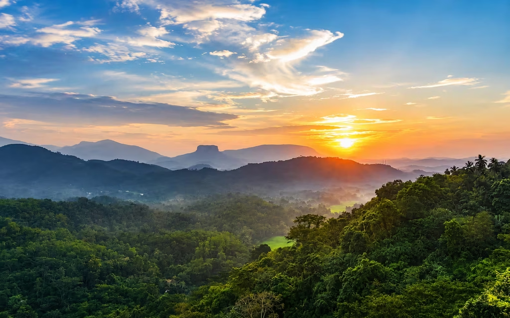
On a clear day, Bathalegala provides broad views over layered hills, valleys, settlements and distant mountain ranges. The perspective is one of the main rewards of the climb because the mountain stands prominently above the surrounding landscape.
Mist is common in Sri Lanka’s uplands and can arrive quickly. A clouded summit is not necessarily a failed hike, but visibility near edges becomes a safety issue. Wait for conditions to improve rather than walking close to drop-offs in thick mist.
Best time of day to hike
Morning is usually the most practical choice because temperatures are cooler and you have more daylight if the climb takes longer than expected. Afternoon cloud and rain can develop in mountainous areas, although weather patterns vary throughout the year.
Avoid beginning late in the day unless you know the route and are certain you can return before darkness. Mountain paths become much harder to follow after sunset.
What to take
Carry more water than you think you will need, especially on a hot day. Wear footwear with grip, bring sun protection and pack a light rain layer. A small first-aid kit, charged phone and offline map can also be useful.
Keep hands free on steeper sections. If you are carrying camera equipment, use a secure backpack rather than hanging heavy gear loosely from one shoulder.
Rain and slippery conditions
Wet rock, grass and exposed soil can become very slippery. A trail that feels straightforward when dry may become significantly harder after rain. If thunderstorms or persistent heavy rain are expected, postponing the hike is usually the better decision.
Do not rely on social-media videos filmed during completely different weather conditions. Local conditions on the day are what matter.
Bathalegala Weather: 7-Day Forecast
Updated automatically with the latest available forecast for Mawanella, Sri Lanka.
- Rain chance
- 100%
- Rainfall
- 25.9 mm
- Wind
- 7 km/h
- UV index
- 8.0
- Sunrise
- 6:01 AM
- Sunset
- 5:47 PM
- Rain chance
- 88%
- Rainfall
- 0.3 mm
- Wind
- 10 km/h
- UV index
- 7.7
- Sunrise
- 6:01 AM
- Sunset
- 5:47 PM
- Rain chance
- 100%
- Rainfall
- 14.4 mm
- Wind
- 7 km/h
- UV index
- 8.1
- Sunrise
- 6:01 AM
- Sunset
- 5:47 PM
- Rain chance
- 100%
- Rainfall
- 20.6 mm
- Wind
- 9 km/h
- UV index
- 7.0
- Sunrise
- 6:02 AM
- Sunset
- 5:47 PM
- Rain chance
- 100%
- Rainfall
- 33.3 mm
- Wind
- 8 km/h
- UV index
- 8.0
- Sunrise
- 6:02 AM
- Sunset
- 5:47 PM
- Rain chance
- 96%
- Rainfall
- 31.5 mm
- Wind
- 14 km/h
- UV index
- 7.8
- Sunrise
- 6:03 AM
- Sunset
- 5:48 PM
- Rain chance
- 96%
- Rainfall
- 10.8 mm
- Wind
- 7 km/h
- UV index
- 8.2
- Sunrise
- 6:03 AM
- Sunset
- 5:48 PM
Photography
Wide-angle photographs work well for showing the summit landscape, while a longer lens can compress distant ridges and settlements. The most dramatic photograph is not worth standing near an unstable edge.
Drones should only be used when legally permitted and without disturbing local residents, wildlife or religious sites. Wind can also be much stronger on an exposed summit than at the trailhead.
Combining Bathalegala with nearby destinations
The hike fits naturally into a route through Kegalle District or between Colombo and Kandy. Mawanella, Kadugannawa and the Balana area are all useful reference points in the wider region. Travelers interested in history can combine mountain scenery with heritage sites rather than making the day purely about hiking.
Keep driving time realistic. Mountain and village roads can be slow, and adding too many stops can turn a rewarding hike into a rushed schedule.
Respecting villages and private land
The approach passes through communities where tourism is only one part of daily life. Do not park across entrances, leave litter, play loud music or photograph residents without permission. If a path crosses private property, ask before continuing.
Buying water, snacks or guide services locally can help ensure some tourism income stays in the community.
Leave no trace
Carry out every piece of plastic and food packaging. Do not carve names into rock, damage plants or create new paths around muddy sections. Repeated shortcuts can widen erosion scars and damage the summit environment.
If you see religious structures or offerings, treat them respectfully. Mountains in Sri Lanka can carry local religious and cultural meaning even when visitors approach them mainly as hiking destinations.
Frequently asked questions
Is Bathalegala the same as Bible Rock?
Yes. Bathalegala is the local name, while Bible Rock is the widely used English nickname based on the mountain’s shape.
Do I need a guide?
Not every experienced hiker will require one, but a local guide is a sensible choice if you do not know the route or conditions are uncertain.
Is the hike suitable in heavy rain?
No. Steep sections can become slippery, and visibility may deteriorate. Postpone the hike when conditions are unsafe.
What is the main attraction?
The combination of a distinctive mountain profile, a physical climb and panoramic views over the surrounding Kegalle landscape is the main appeal.